
Trace a Lafayette Street Directory by Address
The cleanest Lafayette street directory workflow moves from a location key to a source-native name. Start with a complete address, not a guess about who lives there. CCMAP and ParcelQuest can turn the address into a nine-digit APN. The Assessor counter can then supply owner and mailing fields that do not appear on the web map. RecorderWorks connects a confirmed party to a deed or other recorded instrument. Voter and historical directory sources sit after that chain, each with its own boundary.
Use the steps in order. Keep the exact spelling, date, APN, document number, and source label beside every result. That record trail is more useful than a loose collection of names.
- Enter the Lafayette address in CCMAP, wait for the autocomplete suggestion, select it, and click the matching parcel.
- Retain the nine-digit APN, then inspect boundary, situs, area, assessed value, aerial, contour, and map-link context.
- Take the APN to the Contra Costa Assessor counter for owner, mailing, situs, value, or characteristics information that the web map suppresses.
- Search the confirmed owner or party in RecorderWorks, open the purchase deed, and follow the prior grantor as an earlier grantee.
- Apply the voter-file boundary last: My Voter Status is an identity-matched self-lookup, while a full file requires a lawful purpose and an approved request.
A street result can identify parcels and recorded parties without proving who is present today. The distinction keeps the address chain useful and accurate.
CCMAP Fields for a Lafayette Street Directory
The CCMAP viewer is the main street-browse tool for Lafayette. Its address autocomplete is important. Typing a line and pressing on without selecting the suggested match can leave the wrong parcel in view. After selection, click the polygon and record the APN. The county's APN instructions describe the address-to-parcel handoff. The map can then be revisited by parcel key while other sources are checked.
The official Contra Costa property information page describes a free address and APN path. Online results may show a boundary, situs address if assigned, building square footage, lot size, assessed value, aerial and contours, and a map link. Owner and mailing names are intentionally absent from the online map, so the street directory must hand off to the Assessor counter for those fields.
| Field or control | Type | Required | What it does in Lafayette |
|---|---|---|---|
| Address autocomplete | Text and suggestion | Starting key | Matches a situs line before the parcel is opened. |
| APN | Nine-digit identifier | After selection | Retains the assessment parcel, such as 155-280-015, across later searches. |
| Parcel polygon | Map click | Yes for context | Displays boundary and parcel-linked assessment information. |
| Aerial and contours | Layer controls | Optional | Shows slope, apparent access, and nearby parcel context. |
| Map link | Result link | Optional | Preserves a return path to the selected property view. |
- Parcel
- A mapped assessment unit with an APN. A parcel describes land, not every person connected with it.
- Situs address
- The physical location assigned to a parcel. It can differ from the owner's mailing address.
- Plat
- A recorded map that lays out lots, lines, streets, or other land geometry for a subdivision or survey.
- Criss-cross directory
- A reverse directory arranged by address instead of surname. No verified Lafayette run was located, so a local shelf claim needs confirmation.
Browse Lafayette Parcels Along a Street
No inspected Contra Costa portal promises a button that returns every property on Street X. A defensible whole-street search is bounded and manual. Locate one known address, zoom to a defined segment, pan along the road, and click parcels in sequence. Record each APN and stop at a clear boundary. A free web radius selection can narrow a circle around the starting parcel, but a radius is not the same as legal adjacency or a complete street list.
Contours and aerial layers matter in hilly Lafayette. A rooftop that looks close may sit across a flag lot, access strip, creek parcel, or right-of-way. Community View adds zoning, flood, HOA, and public or private street context, but the city warns that it has been unsupported since 2018. CCMAP is the current fallback for parcel inspection, with recorded subdivision and survey maps as stronger evidence when lines are disputed.
The Contra Costa property and zoning lookup shows the county-side starting point for address research.
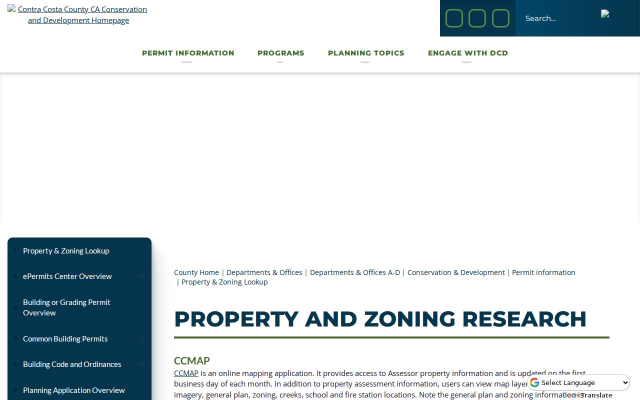
The property lookup view is useful for orienting a Lafayette street directory, but a map layer still identifies land and jurisdiction rather than a complete household.
When the target address fails to match, search nearby and inspect the surrounding polygons. Vacant land may have an APN without a situs line, and a historical address may have changed names or numbers.
Lafayette Records Arranged by Street
Several record sets can be tied to an address, but they do not all describe residents. This coverage table shows where the street trail changes custodian. The APN ties current parcel context to assessor and map systems. The street line helps find permits and older directory entries. A deed uses a legal description and principal parties. A voter file has a separate statutory access route.
| Address-keyed record | Keeper | What it shows | Access |
|---|---|---|---|
| CCMAP / ParcelQuest | County Assessor and GIS | APN, boundary, area, value, aerial, contours | Free web map; no owner names |
| Assessment roll | Contra Costa Assessor | Owner, mailing, situs, value, characteristics | Counter and paid print outputs |
| RecorderWorks | Clerk-Recorder | Deeds, liens, maps, parties, dates, document numbers | Free index for 1986-present; copies ordered |
| Public Works maps | County Public Works | Subdivisions, parcel maps, surveys, corners, current and superseded pages | Free Laserfiche search |
| Building permits | County Building Inspection | Address, permit history, status, contractor route | Accela for 1980-present; documents by request |
| Planning files | Lafayette Planning | Land-use application, zoning, plans, findings, contacts | Major Projects, GeoCivix, or city request |
The coverage is intentionally partial. It can establish an address, parcel, legal party, project, or historical subscriber link. It cannot promise a return-everything-on-a-street roster.
Mailing and Situs in Lafayette Records
The situs address is the property location. The mailing address is where an assessment or tax notice is sent. They may match, but they can also differ because the correspondence goes to a trust, business, agent, second location, post-office box, or a person's chosen mailing point. A mailing match supports a possible connection to the parcel. It does not prove that the person is present there.
The online assessor view omits owner and mailing names. At 2530 Arnold Drive, Suite 100, Martinez, the Assessor counter can provide public owner, mailing, situs, value, and characteristics outputs, subject to protected entries. The office lists 925-313-7400 and weekday hours of 8 to 4. A prepared radius product costs $50, while the web map allows a researcher to select parcels without that prepared-list charge. A homeowners exemption can be a clue about the filed claim, but the claim itself is confidential.
Label each field in notes as situs, mailing, owner, assessee, or value date. That vocabulary prevents a Lafayette street directory from turning a tax correspondence address into a claim about the people at a parcel.
Note: A remote mailing address may locate a taxpayer, but it cannot establish occupancy, household size, or who receives services at the situs.
Build a Lafayette Deed Chain
Once the Assessor supplies a confirmed owner name, move to RecorderWorks rather than searching a street name alone. Search the name as LAST FIRST, allow a partial match when initials vary, and narrow the recording range. The index supports Name, Document Number, Book and Page, Recording Date, Document Type, Map, Legal Description, and Parcel Number modes when available. Document type matters: a deed can transfer an interest, while a deed of trust, reconveyance, lien, easement, or release has a different evidentiary role.
Open the purchase deed and capture grantee, grantor, recording date, document number, type, and the property identifier or legal description shown. Search the grantor as a prior grantee in an earlier range. Repeat until the online period ends. At the 1986 boundary, take exact party names and approximate years to the Clerk-Recorder counter at 555 Escobar Street in Martinez. Older index and document viewing are described as free; ordered copies vary.
The RecorderWorks recorded-document index is a party and instrument search, not a street-browse engine. Use the legal description or APN to reject a same-name deed from another Contra Costa property.
When the goal shifts from a parcel chain to one person's records, the Lafayette resident lookup route applies a separate two-anchor identity check.
Maps That Preserve Lafayette Parcel History
Current APNs are not always the oldest land key. Public Works Laserfiche provides recorded maps, subdivision maps, parcel maps, surveys, corner records, and current or superseded annotated assessor pages. These records can explain a split, a changed parcel number, a shared line, or a legal description that no longer resembles a modern street search. A map reference is often the bridge between a present polygon and an older deed.
Use the Contra Costa Public Works records map search after CCMAP supplies an APN. Search the map family that fits the question: a subdivision or parcel map for lot layout, a survey for measured lines, a corner record for a control point, and an assessor page for historical parcel annotation. A visible structure or road edge is not by itself the legal boundary.
Lafayette's terrain makes the distinction especially useful. Aerial proximity and practical street access can disagree with parcel adjacency. Recorded maps and surveys answer the legal geometry question, while CCMAP supplies current visual context.
Lafayette Permit History Since 1980
County Accela carries Lafayette building permits from January 1, 1980 to the present. Select the Building tab, then use General Search, Property Address, Permit Information or Permit Number, or Licensed Contractor Information. Status and history are free. Plans and supporting applications are not downloadable through the status screen, so a deeper file requires County Records Research.
Permit history can date an addition, demolition, address correction, or major remodel. An applicant, owner, architect, or licensed contractor is connected to a project. That name is not proof of residence. County Records Research accepts requests for plans, permit documents, reports, calculations, and planning files, with an approximate ten-business-day response. Stamped plans may require professional release and can add about 30 days. Code-enforcement history uses 925-655-2710 or 877-646-8314.
The Contra Costa Accela search is therefore a time-and-work record for a Lafayette address, not a household directory.
Note: A permit date can explain a changed structure, but it cannot establish who used the address before, during, or after the work.
City Planning and County Building Custody
Lafayette land-use files and Contra Costa building files meet at the same street address but remain different record streams. The City Planning side uses Major Projects for application number, scope, land-use classification, zoning, lot area, height or stories, floor area, status, plans or images, and contacts. GeoCivix requires an account for submission, and no public historical search was verified. For a city file, the City Clerk's public-record route is the safer request path.
The county performed building plan check, permit issuance, and inspections. County Accela covers the status and history view, while records requests handle plans and supporting material. A complete address chronology may therefore require both the city and the county, plus Public Works maps when parcel lines changed.
The split also follows Lafayette's history. Before incorporation in 1968, early land and building evidence was county-based. Later city planning files do not retroactively contain every earlier activity.
Historic Lafayette Street Names Break Searches
Modern spelling can hide an older Lafayette address. Moraga Road appears as Commercial Street in earlier material. Mt. Diablo Boulevard carried the descriptive label “Road from Oakland to Walnut Creek.” Lafayette itself appears as La Fayette, and older settlement references include Brown's Mill, Brown's Corners, and Centerville. Test those forms in OCR, catalogs, newspaper titles, and deed descriptions instead of searching only today's street name.
The village center also shifted from Golden Gate Way and Second toward Mt. Diablo and Moraga in the early 1860s. “Center of the village” is therefore a date-sensitive description. A historic house may be described by a later number, as with the former Brown house at the present 985 Hough Avenue. The land can continue while the structure, number, or road label changes.
Note: Historical Lafayette searches work best when modern street names, La Fayette spelling, earlier road labels, APNs, and map references are tested together.
County White Pages for Lafayette Address Clues
Countywide telephone books add a named-subscriber layer to a Lafayette street directory. Verified Library of Congress issues include 1934-1941, 1942-1946, 1946-1948, 1949-1950, 1951-1952, selected issues through 1963, an August 1968 Contra Costa volume, and Central Contra Costa issues from 1976-1978. The years are not a verified unbroken run, and these are white and yellow pages, not detailed Polk directories.
A white-page entry normally shows subscriber surname, given name or initial, street address, and telephone number. It does not show every person at the address. A missing listing can reflect an unlisted number, no phone, another household member, an omission, or OCR error. Use the 1968 Contra Costa white pages scan, inspect the printed page, and compare a known surname with deed, tax, or census evidence.
The historical shelf is handled in the Lafayette city directories collection reference. On a street page, the telephone issue remains a supporting occupant clue rather than the main parcel chain.
What a Lafayette Street Directory Cannot Show
A parcel map does not list every person at an address. Renters, household members, children, caregivers, guests, utility subscribers, delivery records, and DMV addresses are not public GIS outputs. A deed names legal parties. A permit names project participants. A white page names a subscriber. A voter file is purpose-limited, and My Voter Status cannot browse a Lafayette block. Protected voters and Safe at Home participants can be absent or represented through lawful safeguards.
Use the label that matches the record: owner, mailing recipient, grantor, grantee, applicant, subscriber, voter, or court party. If the question is who lives there today, the available official records may not answer it. That is a records boundary, not an invitation to infer a household from a nearby name.
Lawful personal use. Lafayette street and address records support legitimate property, family-history, civic, and safety research within each custodian's rules. Do not use identifying information to stalk, harass, intimidate, or harm anyone.